 vesseltracker.com
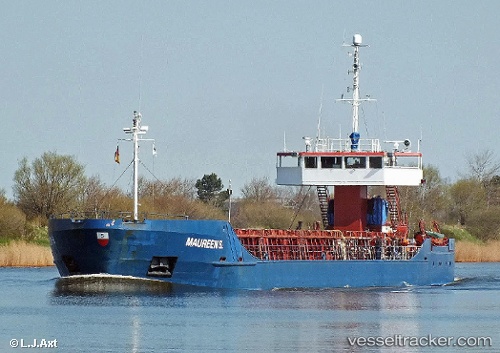
 COE MINA
Current Status
Where is the vessel?
COE MINA is currently in 11 nm SE of Grena, based on AIS data received about 1h ago.
Latest AIS update:
Current position: 56.25184° N, 11.10612° E (11 nm SE of Grena)
Average speed (last 7 days): Loading…
Average speed (last 30 days): Loading…
Vessel profile: COE MINA is a General Cargo with dimensions m x m.
This page combines live AIS, route history, probable destination signals, nearby traffic, and port activity for practical vessel monitoring.
The current position of vessel COE MINA is 56.25184 lat / 11.10612 lng. Updated: 2026-05-14 05:41:46 UTCNearest reference points:
- Near Grena
- Near Glesborg
- Near Eskebjerg
Currently sailing under the flag of San Marino ![]()
Details:
Live Vessel COE MINA Analytics (details, animations, etc.)
Recent AIS points (UTC):
2026-05-14 01:31:38 UTC · 55.77880, 10.81141 · SOG 8.7 kn · COG 8°2026-05-14 03:36:10 UTC · 56.01013, 11.07762 · SOG 6.8 kn · COG 34°
2026-05-14 04:33:47 UTC · 56.11929, 11.09481 · SOG 6.6 kn · COG 7°
2026-05-14 05:41:46 UTC · 56.25184, 11.10612 · SOG 7.1 kn · COG 5°