 vesseltracker.com
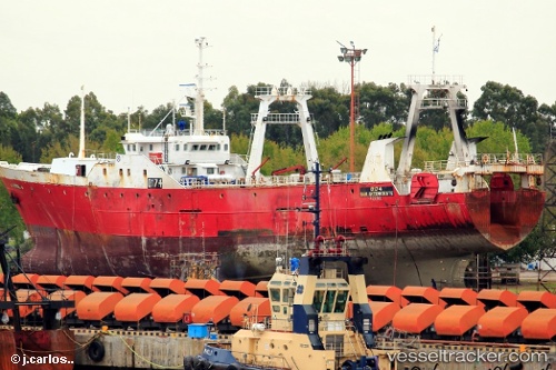
Verdel
Current StatusWhere is the vessel?
Verdel is currently in 163 nm SE of Puerto San Julian, based on AIS data received about 1h ago.
Latest AIS update:
Current position: 50.34248° S, 63.84368° W (163 nm SE of Puerto San Julian)
Average speed (last 7 days): Loading…
Average speed (last 30 days): Loading…
Vessel profile: Verdel is a Fishing Vessel with dimensions 12m x 71m.
This page combines live AIS, route history, probable destination signals, nearby traffic, and port activity for practical vessel monitoring.
The current position of vessel Verdel is -50.34248 lat / -63.84368 lng. Updated: 2026-05-14 07:43:59 UTCDetails:
Live Vessel Verdel Analytics (details, animations, etc.)
Recent AIS points (UTC):
2026-05-14 04:17:09 UTC · -50.42833, -63.74667 · SOG 6 kn · COG -1°2026-05-14 06:17:30 UTC · -50.40920, -63.84003 · SOG 2.3 kn · COG 351°
2026-05-14 07:34:29 UTC · -50.34962, -63.84350 · SOG 2.5 kn · COG 357°
2026-05-14 07:43:59 UTC · -50.34248, -63.84368 · SOG 2.9 kn · COG 6°