 vesseltracker.com
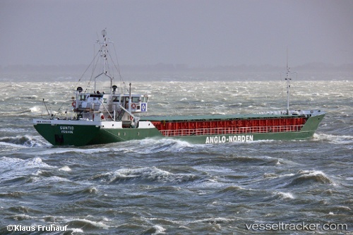
 Suntis
Current Status
Where is the vessel?
Suntis is currently in 13 nm E of SIMRISHAMN, based on AIS data received less than 1h ago.
Latest AIS update:
Current position: 55.61560° N, 14.73060° E (13 nm E of SIMRISHAMN)
Average speed (last 7 days): Loading…
Average speed (last 30 days): Loading…
Vessel profile: Suntis is a Multi Purpose Carrier with dimensions 82m x 11m.
This page combines live AIS, route history, probable destination signals, nearby traffic, and port activity for practical vessel monitoring.
The current position of vessel Suntis is 55.6156 lat / 14.7306 lng. Updated: 2026-05-15 11:44:02 UTCNearest reference points:
- Near TEJN
- Near Sölvesborg
- Near Åhus
Currently sailing under the flag of Germany ![]()
Suntis built in 1985 year
Deadweight:
1815 tDetails:
Live Vessel Suntis Analytics (details, animations, etc.)
Recent AIS points (UTC):
2026-05-15 07:38:12 UTC · 55.02320, 14.17360 · SOG 10.8 kn · COG 38°2026-05-15 10:01:02 UTC · 55.34910, 14.61150 · SOG 10.1 kn · COG 35°
2026-05-15 10:16:24 UTC · 55.38360, 14.65560 · SOG 10 kn · COG 36°
2026-05-15 11:44:02 UTC · 55.61560, 14.73060 · SOG 10.1 kn · COG 0°