 vesseltracker.com
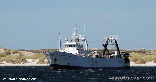
 Paradanta Primero
Current Status
Where is the vessel?
Paradanta Primero is currently in 116 nm NE of Naschel, based on AIS data received about 1h ago.
Latest AIS update:
Current position: 51.43521° S, 63.34089° W (116 nm NE of Naschel)
Average speed (last 7 days): Loading…
Average speed (last 30 days): Loading…
Vessel profile: Paradanta Primero is a Fishing Vessel with dimensions 58m x 58m.
This page combines live AIS, route history, probable destination signals, nearby traffic, and port activity for practical vessel monitoring.
The current position of vessel Paradanta Primero is -51.43521 lat / -63.34089 lng. Updated: 2026-05-13 19:51:41 UTCCurrently sailing under the flag of Spain ![]()
Paradanta Primero built in 1986 year
Deadweight:
931 tDetails:
Live Vessel Paradanta Primero Analytics (details, animations, etc.)
Recent AIS points (UTC):
2026-05-13 17:00:52 UTC · -51.64048, -63.45683 · SOG 4.7 kn · COG 0°2026-05-13 17:19:03 UTC · -51.61667, -63.45167 · SOG 4 kn · COG -1°
2026-05-13 19:34:32 UTC · -51.45516, -63.35193 · SOG 4.5 kn · COG 25°
2026-05-13 19:51:41 UTC · -51.43521, -63.34089 · SOG 4.4 kn · COG 26°