 vesseltracker.com
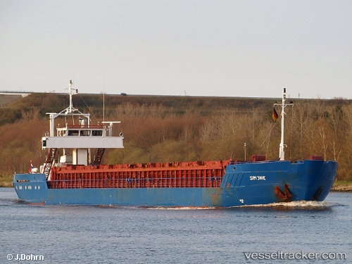
 Nazmiye Ana
Current Status
Where is the vessel?
Nazmiye Ana is currently in 12 nm SE of Methana, based on AIS data received about 63d ago.
Latest AIS update:
Current position: 37.42229° N, 23.70583° E (12 nm SE of Methana)
Average speed (last 7 days): Loading…
Average speed (last 30 days): Loading…
Vessel profile: Nazmiye Ana is a Multi Purpose Carrier with dimensions 79m x 11m.
This page combines live AIS, route history, probable destination signals, nearby traffic, and port activity for practical vessel monitoring.
The current position of vessel Nazmiye Ana is 37.42229 lat / 23.70583 lng. Updated: 2026-03-10 22:39:31 UTCNearest reference points:
- Near Methana
- Near POROS
- Near Galatas Troizinas
Currently sailing under the flag of Panama ![]()
Nazmiye Ana built in 1986 year
Deadweight:
1550 tDetails:
Live Vessel Nazmiye Ana Analytics (details, animations, etc.)
Recent AIS points (UTC):
2026-03-10 22:39:31 UTC · 37.42229, 23.70583 · SOG 4 kn · COG 179°