 vesseltracker.com
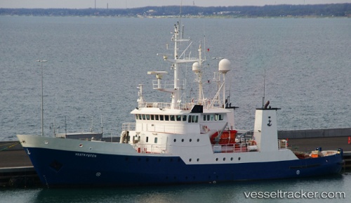
 AMBER AGATHA
Current Status
Where is the vessel?
AMBER AGATHA is currently in Near Mjølkevikvarden, based on AIS data received less than 1h ago.
Latest AIS update:
Current position: 60.50895° N, 4.99668° E (Near Mjølkevikvarden)
Average speed (last 7 days): Loading…
Average speed (last 30 days): Loading…
Vessel profile: AMBER AGATHA is a Fishery Patrol Vessel with dimensions m x m.
This page combines live AIS, route history, probable destination signals, nearby traffic, and port activity for practical vessel monitoring.
The current position of vessel AMBER AGATHA is 60.50895 lat / 4.99668 lng. Updated: 2026-05-14 17:23:24 UTCNearest reference points:
- Near Hakonsvern
- Near Skålevik
- Near Bergen
Currently sailing under the flag of Poland ![]()
Details:
Live Vessel AMBER AGATHA Analytics (details, animations, etc.)
Recent AIS points (UTC):
2026-05-14 14:08:54 UTC · 60.51147, 4.98317 · SOG 0.8 kn · COG -1°2026-05-14 16:09:03 UTC · 60.51333, 4.98178 · SOG 3.2 kn · COG -1°
2026-05-14 16:17:23 UTC · 60.51303, 4.99302 · SOG 2 kn · COG -1°
2026-05-14 17:23:24 UTC · 60.50895, 4.99668 · SOG 0.5 kn · COG 289°