 vesseltracker.com
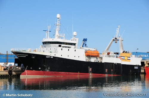
Ocean Breaker
Current StatusWhere is the vessel?
Ocean Breaker is currently in Near Bull Arm, based on AIS data received about 1184d ago.
Latest AIS update:
Current position: 47.81200° N, 53.87858° W (Near Bull Arm)
Average speed (last 7 days): Loading…
Average speed (last 30 days): Loading…
Vessel profile: Ocean Breaker is a Fish Carrier with dimensions 14m x 56m.
This page combines live AIS, route history, probable destination signals, nearby traffic, and port activity for practical vessel monitoring.
The current position of vessel Ocean Breaker is 47.81200 lat / -53.87858 lng. Updated: 2023-02-01 13:16:29 UTCNearest reference points:
- Near Argentia
- Near Catalina
- 17 nm NE of Marystown
Details:
Live Vessel Ocean Breaker Analytics (details, animations, etc.)
Recent AIS points (UTC):
2023-02-01 13:16:29 UTC · 47.81200, -53.87858 · SOG 0 kn · COG 230°