 vesseltracker.com
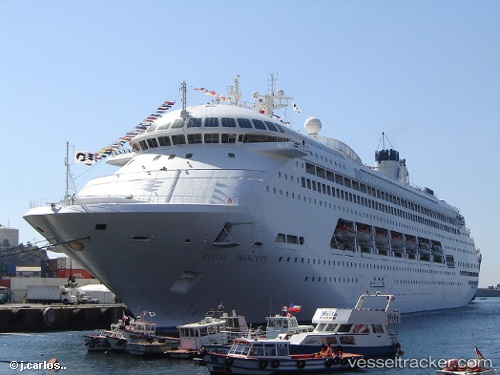
 AMBIENCE
Current Status
Where is the vessel?
AMBIENCE is currently in 27 nm NE of BARFLEUR, based on AIS data received less than 1h ago.
Latest AIS update:
Current position: 49.94730° N, 0.70890° W (27 nm NE of BARFLEUR)
Average speed (last 7 days): Loading…
Average speed (last 30 days): Loading…
Vessel profile: AMBIENCE is a Passenger (Cruise) Ship with dimensions 245m x 35m.
This page combines live AIS, route history, probable destination signals, nearby traffic, and port activity for practical vessel monitoring.
The current position of vessel AMBIENCE is 49.94730 lat / -0.70890 lng. Updated: 2026-04-21 23:54:28 UTCNearest reference points:
- Near Port-en-Bessin-Huppain
- 23 nm S of Ferring
- 15 nm S of Selsey
Currently sailing under the flag of Bahamas ![]()
AMBIENCE built in 1991 year
Deadweight:
7002 tDetails:
Live Vessel AMBIENCE Analytics (details, animations, etc.)
Recent AIS points (UTC):
2026-04-21 19:23:20 UTC · 50.68121, -0.96988 · SOG 9.7 kn · COG 197°2026-04-21 21:31:58 UTC · 50.32941, -0.90116 · SOG 10.2 kn · COG 162°
2026-04-21 22:37:30 UTC · 50.15548, -0.81278 · SOG 9.9 kn · COG 172°
2026-04-21 23:54:28 UTC · 49.94730, -0.70890 · SOG 10.4 kn · COG 166°