 vesseltracker.com
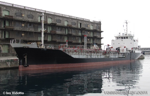
Sea Eunice
Current StatusWhere is the vessel?
Sea Eunice is currently in Near Antan, based on AIS data received about 1024d ago.
Latest AIS update:
Current position: 4.32499° N, 8.25593° E (Near Antan)
Average speed (last 7 days): Loading…
Average speed (last 30 days): Loading…
Vessel profile: Sea Eunice is a Chemical Tanker with dimensions 10m x 74m.
This page combines live AIS, route history, probable destination signals, nearby traffic, and port activity for practical vessel monitoring.
The current position of vessel Sea Eunice is 4.32499 lat / 8.25593 lng. Updated: 2023-07-24 14:34:10 UTCNearest reference points:
- Near Moudi Terminal
- Near Odudu Terminal
- Near Calabar
Details:
Live Vessel Sea Eunice Analytics (details, animations, etc.)
Recent AIS points (UTC):
2023-07-24 14:34:10 UTC · 4.32499, 8.25593 · SOG 0.4 kn · COG 133°