 vesseltracker.com
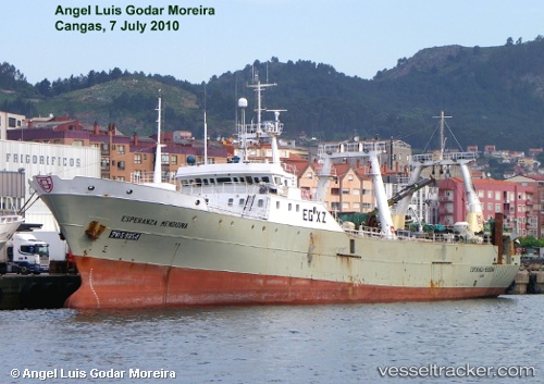
Esperanza Menduina
Current StatusWhere is the vessel?
Esperanza Menduina is currently in 210 nm SE of Mar Del Plata, based on AIS data received less than 1h ago.
Latest AIS update:
Current position: 39.41500° S, 53.39167° W (210 nm SE of Mar Del Plata)
Average speed (last 7 days): Loading…
Average speed (last 30 days): Loading…
Vessel profile: Esperanza Menduina is a Fishing Vessel with dimensions 13m x 80m.
This page combines live AIS, route history, probable destination signals, nearby traffic, and port activity for practical vessel monitoring.
The current position of vessel Esperanza Menduina is -39.41500 lat / -53.39167 lng. Updated: 2026-05-02 19:40:16 UTCNearest reference points:
- 91 nm SE of Punta Medanos
Details:
Live Vessel Esperanza Menduina Analytics (details, animations, etc.)
Recent AIS points (UTC):
2026-05-02 16:16:14 UTC · -39.32833, -53.36167 · SOG 2 kn · COG -1°2026-05-02 17:37:18 UTC · -39.36167, -53.37500 · SOG 2 kn · COG -1°
2026-05-02 19:19:13 UTC · -39.40333, -53.38833 · SOG 2 kn · COG -1°
2026-05-02 19:40:16 UTC · -39.41500, -53.39167 · SOG 2 kn · COG -1°