 vesseltracker.com
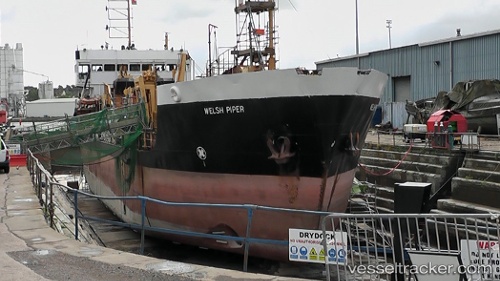
 Welsh Piper
Current Status
Where is the vessel?
Welsh Piper is currently in Near NORMAN ISLAND, based on AIS data received less than 1h ago.
Latest AIS update:
Current position: 18.35959° N, 64.58675° W (Near NORMAN ISLAND)
Average speed (last 7 days): Loading…
Average speed (last 30 days): Loading…
Vessel profile: Welsh Piper is a Dredger with dimensions 69m x 12m.
This page combines live AIS, route history, probable destination signals, nearby traffic, and port activity for practical vessel monitoring.
The current position of vessel Welsh Piper is 18.35959 lat / -64.58675 lng. Updated: 2026-05-13 22:45:29 UTCNearest reference points:
- Near Norman Island
- Near Spanish Town
- Near Charlotte Amalie
Currently sailing under the flag of United Kingdom ![]()
Welsh Piper built in 1987 year
Deadweight:
1923 tDetails:
Live Vessel Welsh Piper Analytics (details, animations, etc.)
Recent AIS points (UTC):
2026-05-13 19:33:29 UTC · 18.35949, -64.58682 · SOG 0 kn · COG 347°2026-05-13 19:54:26 UTC · 18.35952, -64.58688 · SOG 0 kn · COG 348°
2026-05-13 21:48:26 UTC · 18.35950, -64.58683 · SOG 0 kn · COG 350°
2026-05-13 22:45:29 UTC · 18.35959, -64.58675 · SOG 0.1 kn · COG 8°