 vesseltracker.com
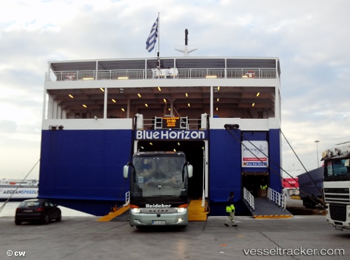
Blue Horizon
Current StatusWhere is the vessel?
Blue Horizon is currently in Near Izmir, based on AIS data received less than 1h ago.
Latest AIS update:
Current position: 38.32254° N, 20.99986° E (Near Izmir)
Average speed (last 7 days): Loading…
Average speed (last 30 days): Loading…
Vessel profile: Blue Horizon is a Passenger Ro Ro Cargo Ship with dimensions 27m x 187m.
This page combines live AIS, route history, probable destination signals, nearby traffic, and port activity for practical vessel monitoring.
The current position of vessel Blue Horizon is 38.32254 lat / 20.99986 lng. Updated: 2026-05-01 00:02:39 UTCNearest reference points:
- Near MESSOLOGGI
- Near Meganísi
- Near Nidhríon
Details:
Live Vessel Blue Horizon Analytics (details, animations, etc.)
Recent AIS points (UTC):
2026-04-30 20:08:19 UTC · 38.22756, 21.71901 · SOG 0 kn · COG 7°2026-04-30 21:46:28 UTC · 38.22667, 21.71833 · SOG 0 kn · COG -1°
2026-04-30 22:10:26 UTC · 38.22759, 21.71902 · SOG 0 kn · COG 6°
2026-05-01 00:02:39 UTC · 38.32254, 20.99986 · SOG 20 kn · COG 312°