 vesseltracker.com
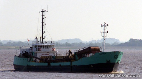
 Penfret
Current Status
Where is the vessel?
Penfret is currently in Near Newport, based on AIS data received about 1h ago.
Latest AIS update:
Current position: 51.55167° N, 2.98833° W (Near Newport)
Average speed (last 7 days): Loading…
Average speed (last 30 days): Loading…
Vessel profile: Penfret is a Hopper Dredger with dimensions 60m x 12m.
This page combines live AIS, route history, probable destination signals, nearby traffic, and port activity for practical vessel monitoring.
The current position of vessel Penfret is 51.55167 lat / -2.98833 lng. Updated: 2026-05-02 22:08:45 UTCNearest reference points:
- Near Bird Port
- Near Penarth
- Near Leckwith
Currently sailing under the flag of United Kingdom ![]()
Details:
Live Vessel Penfret Analytics (details, animations, etc.)
Recent AIS points (UTC):
2026-05-02 19:02:42 UTC · 51.55167, -2.98833 · SOG 0 kn · COG -1°2026-05-02 20:06:00 UTC · 51.55332, -2.98906 · SOG 0 kn · COG 256°
2026-05-02 21:58:37 UTC · 51.55335, -2.98908 · SOG 0 kn · COG 256°
2026-05-02 22:08:45 UTC · 51.55167, -2.98833 · SOG 0 kn · COG -1°