 vesseltracker.com
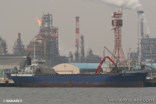
Quan Fu 88
Current StatusWhere is the vessel?
Quan Fu 88 is currently in 17 nm SE of Xiamen Pt, based on AIS data received about 1h ago.
Latest AIS update:
Current position: 24.16525° N, 118.44598° E (17 nm SE of Xiamen Pt)
Average speed (last 7 days): Loading…
Average speed (last 30 days): Loading…
Vessel profile: Quan Fu 88 is a General Cargo Ship with dimensions 13m x 79m.
This page combines live AIS, route history, probable destination signals, nearby traffic, and port activity for practical vessel monitoring.
The current position of vessel Quan Fu 88 is 24.16525 lat / 118.44598 lng. Updated: 2026-05-16 07:51:00 UTCNearest reference points:
- 18 nm S of Xiamen Pt
- 27 nm S of Xiamen Pt
- Near Xiamen Pt
Details:
Live Vessel Quan Fu 88 Analytics (details, animations, etc.)
Recent AIS points (UTC):
2026-05-16 04:45:41 UTC · 24.44273, 118.80369 · SOG 8.7 kn · COG 234°2026-05-16 06:03:00 UTC · 24.32145, 118.65040 · SOG 8.3 kn · COG 236°
2026-05-16 07:46:41 UTC · 24.17077, 118.45418 · SOG 7.7 kn · COG 238°
2026-05-16 07:51:00 UTC · 24.16525, 118.44598 · SOG 7.8 kn · COG 236°