 vesseltracker.com
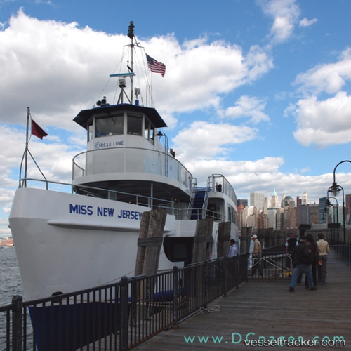
New Jersey
Current StatusWhere is the vessel?
New Jersey is currently in Near Cape May, based on AIS data received about 1h ago.
Latest AIS update:
Current position: 38.92300° N, 75.03223° W (Near Cape May)
Average speed (last 7 days): Loading…
Average speed (last 30 days): Loading…
Vessel profile: New Jersey is a Passenger Ro Ro Cargo Ship with dimensions 22m x 93m.
This page combines live AIS, route history, probable destination signals, nearby traffic, and port activity for practical vessel monitoring.
The current position of vessel New Jersey is 38.92300 lat / -75.03223 lng. Updated: 2026-05-13 11:27:02 UTCNearest reference points:
- Near Slaughter Beach
- Near Corbin City
- 24 nm E of West Ocean City
Details:
Live Vessel New Jersey Analytics (details, animations, etc.)
Recent AIS points (UTC):
2026-05-13 06:29:26 UTC · 38.96843, -74.95928 · SOG 0 kn · COG 297°2026-05-13 09:40:53 UTC · 38.96843, -74.95928 · SOG 0 kn · COG 32°
2026-05-13 10:28:54 UTC · 38.96844, -74.95928 · SOG 0 kn · COG 32°
2026-05-13 11:27:02 UTC · 38.92300, -75.03223 · SOG 12.4 kn · COG 226°