 vesseltracker.com
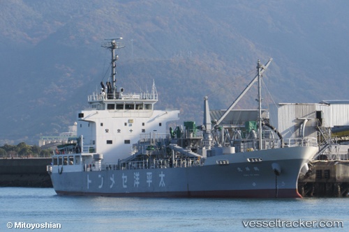
Kakuyoumaru
Current StatusWhere is the vessel?
Kakuyoumaru is currently in Near Shimotsui, based on AIS data received less than 1h ago.
Latest AIS update:
Current position: 34.37810° N, 133.80772° E (Near Shimotsui)
Average speed (last 7 days): Loading…
Average speed (last 30 days): Loading…
Vessel profile: Kakuyoumaru is a Cement Carrier with dimensions 14m x 76m.
This page combines live AIS, route history, probable destination signals, nearby traffic, and port activity for practical vessel monitoring.
The current position of vessel Kakuyoumaru is 34.37810 lat / 133.80772 lng. Updated: 2026-05-14 12:00:37 UTCNearest reference points:
- Near Sakaide
- Near Ayagawa
- Near MIZUSHIMA
Details:
Live Vessel Kakuyoumaru Analytics (details, animations, etc.)
Recent AIS points (UTC):
2026-05-14 07:52:49 UTC · 34.55998, 134.80626 · SOG 13.4 kn · COG 246°2026-05-14 10:27:28 UTC · 34.42373, 134.17021 · SOG 13.3 kn · COG 290°
2026-05-14 11:02:57 UTC · 34.43080, 134.02341 · SOG 12.2 kn · COG 241°
2026-05-14 12:00:37 UTC · 34.37810, 133.80772 · SOG 11.5 kn · COG 262°