 vesseltracker.com
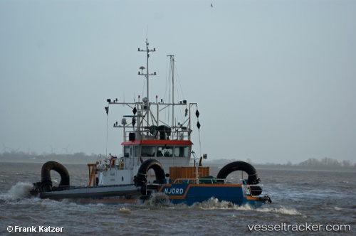
 NJORD
NJORD
Current Status
Where is the vessel?
NJORD is currently in Near NAVEGANTES, based on AIS data received less than 1h ago.
Latest AIS update:
Current position: 26.90852° S, 48.65198° W (Near NAVEGANTES)
Average speed (last 7 days): Loading…
Average speed (last 30 days): Loading…
Vessel profile: NJORD is a Tug with dimensions 35m x 12m.
This page combines live AIS, route history, probable destination signals, nearby traffic, and port activity for practical vessel monitoring.
The current position of vessel NJORD is -26.90852 lat / -48.65198 lng. Updated: 2026-05-14 03:37:01 UTCNearest reference points:
- Near Itajai
- 10 nm NE of CAMBORIU
- 32 nm E of Caioba
Currently sailing under the flag of St Vincent and Grenadines ![]()
NJORD built in 1994 year
Deadweight:
0 tDetails:
Live Vessel NJORD Analytics (details, animations, etc.)
Recent AIS points (UTC):
2026-05-13 23:38:30 UTC · -26.90854, -48.65199 · SOG 0 kn · COG 320°2026-05-14 02:03:50 UTC · -26.90853, -48.65201 · SOG 0 kn · COG 323°
2026-05-14 02:51:41 UTC · -26.90854, -48.65200 · SOG 0 kn · COG 320°
2026-05-14 03:37:01 UTC · -26.90852, -48.65198 · SOG 0 kn · COG 321°