 vesseltracker.com
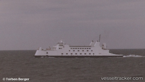
Pt Barnum
Current StatusWhere is the vessel?
Pt Barnum is currently in Near New London, based on AIS data received about 1h ago.
Latest AIS update:
Current position: 41.37957° N, 72.09537° W (Near New London)
Average speed (last 7 days): Loading…
Average speed (last 30 days): Loading…
Vessel profile: Pt Barnum is a Passenger Ro Ro Cargo Ship with dimensions 20m x 100m.
This page combines live AIS, route history, probable destination signals, nearby traffic, and port activity for practical vessel monitoring.
The current position of vessel Pt Barnum is 41.37957 lat / -72.09537 lng. Updated: 2026-05-14 02:25:36 UTCNearest reference points:
- Near PLUM ISLAND
- Near Springville, Suffolk
- Near JUDITH POINT
Details:
Live Vessel Pt Barnum Analytics (details, animations, etc.)
Recent AIS points (UTC):
2026-05-13 23:03:56 UTC · 41.37957, -72.09536 · SOG 0 kn · COG -1°2026-05-14 00:22:56 UTC · 41.37956, -72.09536 · SOG 0 kn · COG -1°
2026-05-14 01:41:38 UTC · 41.37957, -72.09539 · SOG 0 kn · COG -1°
2026-05-14 02:25:36 UTC · 41.37957, -72.09537 · SOG 0 kn · COG -1°