 vesseltracker.com
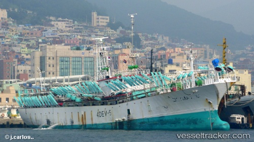
Skymax 101
Current StatusWhere is the vessel?
Skymax 101 is currently in 145 nm NW of Port San Carlos, based on AIS data received less than 1h ago.
Latest AIS update:
Current position: 49.28347° S, 60.51034° W (145 nm NW of Port San Carlos)
Average speed (last 7 days): Loading…
Average speed (last 30 days): Loading…
Vessel profile: Skymax 101 is a Fishing Vessel with dimensions 10m x 125m.
This page combines live AIS, route history, probable destination signals, nearby traffic, and port activity for practical vessel monitoring.
The current position of vessel Skymax 101 is -49.28347 lat / -60.51034 lng. Updated: 2026-05-13 19:50:41 UTCDetails:
Live Vessel Skymax 101 Analytics (details, animations, etc.)
Recent AIS points (UTC):
2026-05-13 17:04:22 UTC · -49.29218, -60.47906 · SOG 0.8 kn · COG 199°2026-05-13 17:19:08 UTC · -49.29078, -60.47990 · SOG 0.8 kn · COG 202°
2026-05-13 19:34:08 UTC · -49.28364, -60.50222 · SOG 0.4 kn · COG 215°
2026-05-13 19:50:41 UTC · -49.28347, -60.51034 · SOG 8.4 kn · COG 270°