 vesseltracker.com
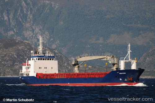
 Gullaas
Current Status
Where is the vessel?
Gullaas is currently in Near Sørarnoy, based on AIS data received about 1h ago.
Latest AIS update:
Current position: 67.16952° N, 14.06002° E (Near Sørarnoy)
Average speed (last 7 days): Loading…
Average speed (last 30 days): Loading…
Vessel profile: Gullaas is a Deck Cargo Ship with dimensions 67m x 11m.
This page combines live AIS, route history, probable destination signals, nearby traffic, and port activity for practical vessel monitoring.
The current position of vessel Gullaas is 67.16952 lat / 14.06002 lng. Updated: 2026-05-14 05:47:34 UTCNearest reference points:
- Near Misten
- Near Ørnes
- Near Tonnes
Currently sailing under the flag of Norway ![]()
Gullaas built in 1987 year
Deadweight:
1218 tDetails:
Live Vessel Gullaas Analytics (details, animations, etc.)
Recent AIS points (UTC):
2026-05-14 01:31:32 UTC · 66.65939, 13.11961 · SOG 9.3 kn · COG 20°2026-05-14 03:44:33 UTC · 66.95667, 13.49246 · SOG 9.3 kn · COG 45°
2026-05-14 04:33:22 UTC · 67.01541, 13.76366 · SOG 9.1 kn · COG 45°
2026-05-14 05:47:34 UTC · 67.16952, 14.06002 · SOG 9.3 kn · COG 23°