 vesseltracker.com
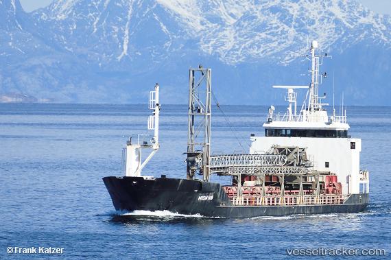
 Nidaroe
Current Status
Where is the vessel?
Nidaroe is currently in Near Mo I Rana, based on AIS data received less than 1h ago.
Latest AIS update:
Current position: 66.28963° N, 14.02365° E (Near Mo I Rana)
Average speed (last 7 days): Loading…
Average speed (last 30 days): Loading…
Vessel profile: Nidaroe is a General Cargo Ship with dimensions 67m x 12m.
This page combines live AIS, route history, probable destination signals, nearby traffic, and port activity for practical vessel monitoring.
The current position of vessel Nidaroe is 66.28963 lat / 14.02365 lng. Updated: 2026-05-14 17:23:19 UTCNearest reference points:
- Near Ørnes
- Near Tonnes
- Near Vikholmen
Currently sailing under the flag of Norway ![]()
Nidaroe built in 1987 year
Deadweight:
1720 tDetails:
Live Vessel Nidaroe Analytics (details, animations, etc.)
Recent AIS points (UTC):
2026-05-14 14:08:50 UTC · 66.20366, 13.21267 · SOG 5.8 kn · COG 53°2026-05-14 16:08:59 UTC · 66.24552, 13.67956 · SOG 6.7 kn · COG 72°
2026-05-14 16:12:51 UTC · 66.24764, 13.69606 · SOG 6.7 kn · COG 75°
2026-05-14 17:23:19 UTC · 66.28963, 14.02365 · SOG 7.4 kn · COG 65°