 vesseltracker.com
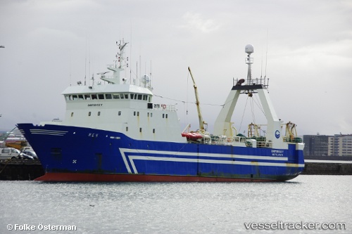
 UMLUNGISI
Current Status
Where is the vessel?
UMLUNGISI is currently in 54 nm S of Moorreesburg, based on AIS data received less than 1h ago.
Latest AIS update:
Current position: 35.39160° S, 18.74704° E (54 nm S of Moorreesburg)
Average speed (last 7 days): Loading…
Average speed (last 30 days): Loading…
Vessel profile: UMLUNGISI is a Fishing with dimensions m x m.
This page combines live AIS, route history, probable destination signals, nearby traffic, and port activity for practical vessel monitoring.
The current position of vessel UMLUNGISI is -35.39160 lat / 18.74704 lng. Updated: 2026-04-28 06:06:09 UTCNearest reference points:
- 15 nm SE of Moorreesburg
- 18 nm SW of Cape Of Good Hope
- Near Mitchells Plain
Currently sailing under the flag of South Africa ![]()
Details:
Live Vessel UMLUNGISI Analytics (details, animations, etc.)
Recent AIS points (UTC):
2026-04-28 02:33:22 UTC · -35.53171, 18.90868 · SOG 3.5 kn · COG 316°2026-04-28 04:00:41 UTC · -35.47969, 18.83048 · SOG 3.3 kn · COG 321°
2026-04-28 04:47:17 UTC · -35.44703, 18.79531 · SOG 3.4 kn · COG 335°
2026-04-28 06:06:09 UTC · -35.39160, 18.74704 · SOG 1.3 kn · COG 321°