 vesseltracker.com
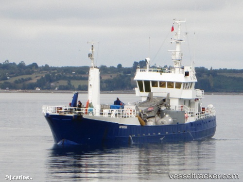
Grip Superior
Current StatusWhere is the vessel?
Grip Superior is currently in Near Puerto Montt, based on AIS data received less than 1h ago.
Latest AIS update:
Current position: 41.49299° S, 72.98349° W (Near Puerto Montt)
Average speed (last 7 days): Loading…
Average speed (last 30 days): Loading…
Vessel profile: Grip Superior is a Fishing Vessel with dimensions 8m x 50m.
This page combines live AIS, route history, probable destination signals, nearby traffic, and port activity for practical vessel monitoring.
The current position of vessel Grip Superior is -41.49299 lat / -72.98349 lng. Updated: 2026-05-16 10:13:16 UTCNearest reference points:
- Near Puerto Montt
- Near Chonchi
- Near Quellón (Puerto Quellón)
Details:
Live Vessel Grip Superior Analytics (details, animations, etc.)
Recent AIS points (UTC):
2026-05-16 05:52:16 UTC · -41.49299, -72.98351 · SOG 0 kn · COG 198°2026-05-16 07:40:19 UTC · -41.49299, -72.98351 · SOG 0 kn · COG 198°
2026-05-16 08:04:16 UTC · -41.49300, -72.98352 · SOG 0 kn · COG 198°
2026-05-16 10:13:16 UTC · -41.49299, -72.98349 · SOG 0 kn · COG 198°