 vesseltracker.com
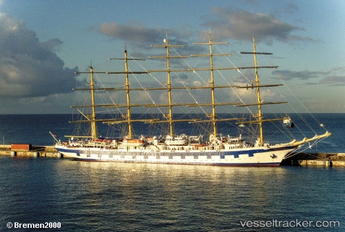
 Royal Clipper
Current Status
Where is the vessel?
Royal Clipper is currently in 12 nm NW of CALVI, based on AIS data received about 2h ago.
Latest AIS update:
Current position: 42.70200° N, 8.56773° E (12 nm NW of CALVI)
Average speed (last 7 days): Loading…
Average speed (last 30 days): Loading…
Vessel profile: Royal Clipper is a Cruise Ship with dimensions 137m x 16m.
This page combines live AIS, route history, probable destination signals, nearby traffic, and port activity for practical vessel monitoring.
The current position of vessel Royal Clipper is 42.702 lat / 8.56773 lng. Updated: 2026-05-13 17:29:31 UTCNearest reference points:
- 26 nm W of Macinaggio
- 20 nm SE of Cabanas
- Near Ajaccio
Currently sailing under the flag of Malta ![]()
Royal Clipper built in 2000 year
Deadweight:
1000 tDetails:
Live Vessel Royal Clipper Analytics (details, animations, etc.)
Recent AIS points (UTC):
2026-05-13 14:18:20 UTC · 42.56500, 8.77333 · SOG 0 kn · COG -1°2026-05-13 15:34:51 UTC · 42.56580, 8.77423 · SOG 0.2 kn · COG 231°
2026-05-13 16:35:01 UTC · 42.61930, 8.71513 · SOG 9.2 kn · COG 305°
2026-05-13 17:29:31 UTC · 42.70200, 8.56773 · SOG 9.1 kn · COG 300°