 vesseltracker.com
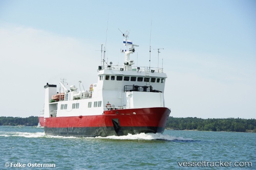
 Eivor
Eivor
Current Status
Where is the vessel?
Eivor is currently in Near Korpo (Korppoo), based on AIS data received about 2h ago.
Latest AIS update:
Current position: 60.16431° N, 21.70520° E (Near Korpo (Korppoo))
Average speed (last 7 days): Loading…
Average speed (last 30 days): Loading…
Vessel profile: Eivor is a Passenger Ro Ro Cargo Ship with dimensions 40m x 10m.
This page combines live AIS, route history, probable destination signals, nearby traffic, and port activity for practical vessel monitoring.
The current position of vessel Eivor is 60.16431 lat / 21.70520 lng. Updated: 2026-05-14 10:06:52 UTCNearest reference points:
- Near Nagu (Nauvo)
- Near Rouhu
- Near Pansio
Currently sailing under the flag of Finland ![]()
Eivor built in 1990 year
Deadweight:
100 tDetails:
Live Vessel Eivor Analytics (details, animations, etc.)
Recent AIS points (UTC):
2026-05-14 07:23:30 UTC · 60.16432, 21.70520 · SOG 0 kn · COG 298°2026-05-14 07:28:31 UTC · 60.16432, 21.70520 · SOG 0 kn · COG 298°
2026-05-14 09:36:20 UTC · 60.16431, 21.70520 · SOG 0 kn · COG 298°
2026-05-14 10:06:52 UTC · 60.16431, 21.70520 · SOG 0 kn · COG 298°