 vesseltracker.com
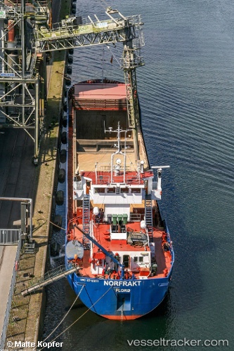
 Norfrakt
Current Status
Where is the vessel?
Norfrakt is currently in Near Drammen, based on AIS data received less than 1h ago.
Latest AIS update:
Current position: 59.72709° N, 10.25395° E (Near Drammen)
Average speed (last 7 days): Loading…
Average speed (last 30 days): Loading…
Vessel profile: Norfrakt is a Multi Purpose Carrier with dimensions 74m x 12m.
This page combines live AIS, route history, probable destination signals, nearby traffic, and port activity for practical vessel monitoring.
The current position of vessel Norfrakt is 59.72709 lat / 10.25395 lng. Updated: 2026-04-24 04:31:29 UTCNearest reference points:
- Near Langøya
- Near Billingstad
- Near Slemmestad
Currently sailing under the flag of Norway ![]()
Norfrakt built in 1988 year
Deadweight:
2181 tDetails:
Live Vessel Norfrakt Analytics (details, animations, etc.)
Recent AIS points (UTC):
2026-04-24 01:18:58 UTC · 59.64795, 10.40568 · SOG 10.2 kn · COG 344°2026-04-24 01:57:10 UTC · 59.72551, 10.27645 · SOG 6.7 kn · COG 311°
2026-04-24 03:49:09 UTC · 59.72711, 10.25390 · SOG 0 kn · COG 133°
2026-04-24 04:31:29 UTC · 59.72709, 10.25395 · SOG 0 kn · COG 134°