 vesseltracker.com
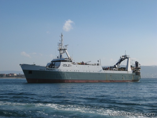
 Robin M. Lee
Current Status
Where is the vessel?
Robin M. Lee is currently in 220 nm S of Sao Filipe, based on AIS data received less than 1h ago.
Latest AIS update:
Current position: 11.23333° N, 24.42333° W (220 nm S of Sao Filipe)
Average speed (last 7 days): Loading…
Average speed (last 30 days): Loading…
Vessel profile: Robin M. Lee is a Fishing Vessel with dimensions 70m x 70m.
This page combines live AIS, route history, probable destination signals, nearby traffic, and port activity for practical vessel monitoring.
The current position of vessel Robin M. Lee is 11.23333 lat / -24.42333 lng. Updated: 2026-05-14 07:55:01 UTCCurrently sailing under the flag of UK ![]()
Robin M. Lee built in 1989 year
Deadweight:
744 tDetails:
Live Vessel Robin M. Lee Analytics (details, animations, etc.)
Recent AIS points (UTC):
2026-05-14 04:18:59 UTC · 10.57500, -24.69667 · SOG 12 kn · COG -1°2026-05-14 05:51:48 UTC · 10.86120, -24.57920 · SOG 11.8 kn · COG 27°
2026-05-14 07:37:00 UTC · 11.17937, -24.44693 · SOG 11.8 kn · COG 24°
2026-05-14 07:55:01 UTC · 11.23333, -24.42333 · SOG 11 kn · COG -1°