 vesseltracker.com
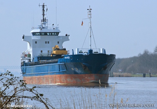
 Hav Nes
Current Status
Where is the vessel?
Hav Nes is currently in Near Vallersund, based on AIS data received about 1h ago.
Latest AIS update:
Current position: 63.87683° N, 9.71809° E (Near Vallersund)
Average speed (last 7 days): Loading…
Average speed (last 30 days): Loading…
Vessel profile: Hav Nes is a Multi Purpose Carrier with dimensions 75m x 75m.
This page combines live AIS, route history, probable destination signals, nearby traffic, and port activity for practical vessel monitoring.
The current position of vessel Hav Nes is 63.87683 lat / 9.71809 lng. Updated: 2026-05-14 11:39:50 UTCNearest reference points:
- Near Uthaug
- Near Trondheim
- Near Dyrvik
Currently sailing under the flag of Faroe Is ![]()
Hav Nes built in 1991 year
Deadweight:
3080 tDetails:
Live Vessel Hav Nes Analytics (details, animations, etc.)
Recent AIS points (UTC):
2026-05-14 08:27:31 UTC · 63.51213, 9.14700 · SOG 9.6 kn · COG 63°2026-05-14 10:13:00 UTC · 63.69654, 9.50693 · SOG 9.1 kn · COG 4°
2026-05-14 10:41:51 UTC · 63.76409, 9.54061 · SOG 8.4 kn · COG 20°
2026-05-14 11:39:50 UTC · 63.87683, 9.71809 · SOG 8.5 kn · COG 51°