 vesseltracker.com
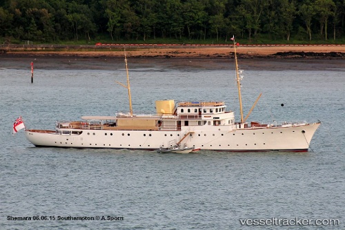
Shemara
Current StatusWhere is the vessel?
Shemara is currently in 248 nm SE of Luque, based on AIS data received less than 1h ago.
Latest AIS update:
Current position: 21.63333° N, 55.40667° W (248 nm SE of Luque)
Average speed (last 7 days): Loading…
Average speed (last 30 days): Loading…
Vessel profile: Shemara is a Yacht with dimensions 9m x 65m.
This page combines live AIS, route history, probable destination signals, nearby traffic, and port activity for practical vessel monitoring.
The current position of vessel Shemara is 21.63333 lat / -55.40667 lng. Updated: 2026-04-25 10:15:27 UTCNearest reference points:
- 344 nm S of Luque
- Open sea, approx. 400 nm off the nearest listed port
- Open sea, approx. 401 nm off the nearest listed port
Details:
Live Vessel Shemara Analytics (details, animations, etc.)
Recent AIS points (UTC):
2026-04-25 07:30:26 UTC · 21.38333, -55.87333 · SOG 10 kn · COG -1°2026-04-25 07:36:29 UTC · 21.39333, -55.85667 · SOG 10 kn · COG -1°
2026-04-25 10:07:41 UTC · 21.62300, -55.43015 · SOG 10.8 kn · COG 63°
2026-04-25 10:15:27 UTC · 21.63333, -55.40667 · SOG 10 kn · COG -1°