 vesseltracker.com
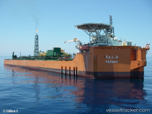
Farwah
Current StatusWhere is the vessel?
Farwah is currently in Near Didon, based on AIS data received about 1h ago.
Latest AIS update:
Current position: 33.84949° N, 12.03273° E (Near Didon)
Average speed (last 7 days): Loading…
Average speed (last 30 days): Loading…
Vessel profile: Farwah is a Offshore Support Vessel with dimensions 44m x 220m.
This page combines live AIS, route history, probable destination signals, nearby traffic, and port activity for practical vessel monitoring.
The current position of vessel Farwah is 33.84949 lat / 12.03273 lng. Updated: 2026-05-14 07:49:52 UTCNearest reference points:
- 37 nm E of Didon
- 22 nm NW of Tarabulus
- Near Ksour Essaf
Details:
Live Vessel Farwah Analytics (details, animations, etc.)
Recent AIS points (UTC):
2026-05-13 21:52:30 UTC · 33.84974, 12.03214 · SOG 0.1 kn · COG 112°2026-05-13 21:52:30 UTC · 33.84974, 12.03214 · SOG 0.1 kn · COG 112°
2026-05-14 07:49:52 UTC · 33.84949, 12.03273 · SOG 0.1 kn · COG 238°
2026-05-14 07:49:52 UTC · 33.84949, 12.03273 · SOG 0.1 kn · COG 238°