 vesseltracker.com
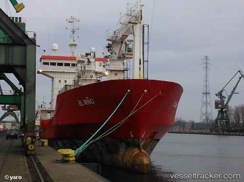
 EL NINO
Current Status
Where is the vessel?
EL NINO is currently in Near Weihai Pt, based on AIS data received less than 1h ago.
Latest AIS update:
Current position: 37.46152° N, 122.23532° E (Near Weihai Pt)
Average speed (last 7 days): Loading…
Average speed (last 30 days): Loading…
Vessel profile: EL NINO is a Refrigerated Cargo Ship with dimensions 14m x 87m.
This page combines live AIS, route history, probable destination signals, nearby traffic, and port activity for practical vessel monitoring.
The current position of vessel EL NINO is 37.46152 lat / 122.23532 lng. Updated: 2026-05-14 17:37:21 UTCNearest reference points:
- Near Weihai Pt
- Near Wei Hai Wei
- Near Weihaiwei
Currently sailing under the flag of Congo (Democratic Republic) ![]()
EL NINO built in 1989 year
Deadweight:
3200 tDetails:
Live Vessel EL NINO Analytics (details, animations, etc.)
Recent AIS points (UTC):
2026-05-14 14:01:22 UTC · 37.46153, 122.23533 · SOG 0 kn · COG -1°2026-05-14 15:46:22 UTC · 37.46150, 122.23536 · SOG 0 kn · COG -1°
2026-05-14 16:55:20 UTC · 37.46153, 122.23532 · SOG 0 kn · COG -1°
2026-05-14 17:37:21 UTC · 37.46152, 122.23532 · SOG 0 kn · COG -1°