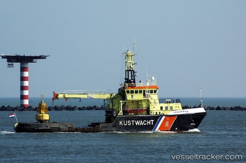
 Terschelling
Current Status
Where is the vessel?
Terschelling is currently in Near TERSCHELLING, based on AIS data received about 14h ago.
Latest AIS update:
Current position: 53.36226° N, 5.21924° E (Near TERSCHELLING)
Average speed (last 7 days): Loading…
Average speed (last 30 days): Loading…
Vessel profile: Terschelling is a Buoy Lighthouse Vessel with dimensions 44m x 44m.
This page combines live AIS, route history, probable destination signals, nearby traffic, and port activity for practical vessel monitoring.
The current position of vessel Terschelling is 53.36226 lat / 5.21924 lng. Updated: 2026-05-23 20:01:29 UTCNearest reference points:
- Near HARLINGEN
- Near Wonseradeel/Makkum
- Near FRANEKER
Currently sailing under the flag of Netherlands ![]()
Terschelling built in 1988 year
Details:
Live Vessel Terschelling Analytics (details, animations, etc.)
Recent AIS points (UTC):
2026-05-23 15:55:28 UTC · 53.36225, 5.21924 · SOG 0 kn · COG 212°2026-05-23 16:01:29 UTC · 53.36225, 5.21923 · SOG 0 kn · COG 212°
2026-05-23 17:43:30 UTC · 53.36225, 5.21924 · SOG 0 kn · COG 212°
2026-05-23 20:01:29 UTC · 53.36226, 5.21924 · SOG 0 kn · COG 212°