 vesseltracker.com
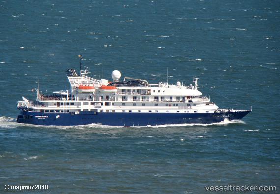
 Hebridean Sky
Current Status
Where is the vessel?
Hebridean Sky is currently in Near La Cuesta Tenerife, based on AIS data received less than 1h ago.
Latest AIS update:
Current position: 28.24786° N, 16.28187° W (Near La Cuesta Tenerife)
Average speed (last 7 days): Loading…
Average speed (last 30 days): Loading…
Vessel profile: Hebridean Sky is a Cruise Ship with dimensions 91m x 16m.
This page combines live AIS, route history, probable destination signals, nearby traffic, and port activity for practical vessel monitoring.
The current position of vessel Hebridean Sky is 28.24786 lat / -16.28187 lng. Updated: 2026-05-14 22:22:57 UTCNearest reference points:
- Near Las Galletas
- Near LOS CRISTIANOS
- Near San Nicolás
Currently sailing under the flag of Bahamas ![]()
Hebridean Sky built in 1991 year
Deadweight:
645 tDetails:
Live Vessel Hebridean Sky Analytics (details, animations, etc.)
Recent AIS points (UTC):
2026-05-14 18:06:31 UTC · 28.47022, -16.24245 · SOG 0 kn · COG 26°2026-05-14 19:09:33 UTC · 28.47022, -16.24245 · SOG 0 kn · COG 27°
2026-05-14 19:48:32 UTC · 28.47021, -16.24245 · SOG 0 kn · COG 27°
2026-05-14 22:22:57 UTC · 28.24786, -16.28187 · SOG 11.5 kn · COG 213°