 vesseltracker.com
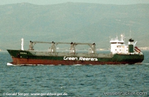
 Green Selje
Current Status
Where is the vessel?
Green Selje is currently in Near Mithivirdi, based on AIS data received about 534d ago.
Latest AIS update:
Current position: 21.37725° N, 72.16850° E (Near Mithivirdi)
Average speed (last 7 days): Loading…
Average speed (last 30 days): Loading…
Vessel profile: Green Selje is a Refrigerated Cargo Ship with dimensions 109m x 18m.
This page combines live AIS, route history, probable destination signals, nearby traffic, and port activity for practical vessel monitoring.
The current position of vessel Green Selje is 21.37725 lat / 72.16850 lng. Updated: 2024-11-13 20:02:22 UTCNearest reference points:
- Near Mithivirdi
- Near Bhavnagar
- Near DAHEJ
Currently sailing under the flag of Bahamas ![]()
Green Selje built in 1989 year
Deadweight:
6120 tDetails:
Live Vessel Green Selje Analytics (details, animations, etc.)
Recent AIS points (UTC):
2024-11-13 20:02:22 UTC · 21.37725, 72.16850 · SOG 0.1 kn · COG -1°