 vesseltracker.com
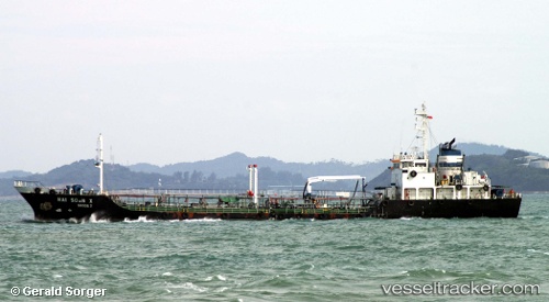
 RUYI SATU
Current Status
Where is the vessel?
RUYI SATU is currently in 358 nm N of Maitri, based on AIS data received about 440d ago.
Latest AIS update:
Current position: 65.05074° S, 6.99056° E (358 nm N of Maitri)
Average speed (last 7 days): Loading…
Average speed (last 30 days): Loading…
Vessel profile: RUYI SATU is a Oil Products Tanker with dimensions 13m x 89m.
This page combines live AIS, route history, probable destination signals, nearby traffic, and port activity for practical vessel monitoring.
The current position of vessel RUYI SATU is -65.05074 lat / 6.99056 lng. Updated: 2025-02-15 10:05:46 UTCNearest reference points:
- Open sea, approx. 404 nm off the nearest listed port
- Open sea (no nearby ports in database)
- Open sea, approx. 508 nm off the nearest listed port
Currently sailing under the flag of Malaysia ![]()
RUYI SATU built in 1988 year
Deadweight:
2998 tDetails:
Live Vessel RUYI SATU Analytics (details, animations, etc.)
Recent AIS points (UTC):
2025-02-15 10:05:46 UTC · -65.05074, 6.99056 · SOG 16 kn · COG 158°