 vesseltracker.com
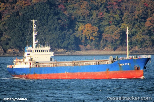
 HARMONY
Current Status
Where is the vessel?
HARMONY is currently in 152 nm NW of El Obeid, based on AIS data received about 458d ago.
Latest AIS update:
Current position: 14.99997° N, 28.40322° E (152 nm NW of El Obeid)
Average speed (last 7 days): Loading…
Average speed (last 30 days): Loading…
Vessel profile: HARMONY is a General Cargo Ship with dimensions 75m x 12m.
This page combines live AIS, route history, probable destination signals, nearby traffic, and port activity for practical vessel monitoring.
The current position of vessel HARMONY is 14.99997 lat / 28.40322 lng. Updated: 2025-02-13 09:56:35 UTCNearest reference points:
- 153 nm NW of El Obeid
- 203 nm NW of El Obeid
Currently sailing under the flag of Palau (Republic of) ![]()
HARMONY built in 1988 year
Deadweight:
1262 tDetails:
Live Vessel HARMONY Analytics (details, animations, etc.)
Recent AIS points (UTC):
2025-02-13 09:56:35 UTC · 14.99997, 28.40322 · SOG 13 kn · COG 320°