 vesseltracker.com
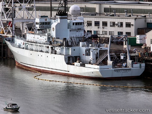
 Thomas G Thompson
Current Status
Where is the vessel?
Thomas G Thompson is currently in 214 nm SW of Fagali'i Airport, based on AIS data received about 1h ago.
Latest AIS update:
Current position: 16.65833° S, 174.31332° W (214 nm SW of Fagali'i Airport)
Average speed (last 7 days): Loading…
Average speed (last 30 days): Loading…
Vessel profile: Thomas G Thompson is a Research Vessel with dimensions 83m x 83m.
This page combines live AIS, route history, probable destination signals, nearby traffic, and port activity for practical vessel monitoring.
The current position of vessel Thomas G Thompson is -16.65833 lat / -174.31332 lng. Updated: 2026-04-30 23:32:47 UTCCurrently sailing under the flag of USA ![]()
Thomas G Thompson built in 1991 year
Details:
Live Vessel Thomas G Thompson Analytics (details, animations, etc.)
Recent AIS points (UTC):
2026-04-30 19:45:54 UTC · -17.37596, -174.54588 · SOG 12.2 kn · COG 16°2026-04-30 21:51:08 UTC · -16.97804, -174.41663 · SOG 11.7 kn · COG 15°
2026-04-30 22:15:56 UTC · -16.90050, -174.39304 · SOG 11.7 kn · COG 19°
2026-04-30 23:32:47 UTC · -16.65833, -174.31332 · SOG 11 kn · COG -1°