 vesseltracker.com
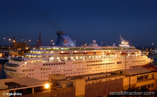
 MAJESTY
Current Status
Where is the vessel?
MAJESTY is currently in 83 nm SW of Al Qahmah, based on AIS data received less than 1h ago.
Latest AIS update:
Current position: 17.28353° N, 40.43939° E (83 nm SW of Al Qahmah)
Average speed (last 7 days): Loading…
Average speed (last 30 days): Loading…
Vessel profile: MAJESTY is a Passengers Ship with dimensions m x m.
This page combines live AIS, route history, probable destination signals, nearby traffic, and port activity for practical vessel monitoring.
The current position of vessel MAJESTY is 17.28353 lat / 40.43939 lng. Updated: 2026-05-16 11:53:19 UTCNearest reference points:
- 92 nm SW of Al Qahmah
- 99 nm SW of Al Qunfudah
- 81 nm NW of As Salif
Currently sailing under the flag of Malta ![]()
Details:
Live Vessel MAJESTY Analytics (details, animations, etc.)
Recent AIS points (UTC):
2026-05-16 08:18:46 UTC · 17.90121, 39.99854 · SOG 12.3 kn · COG 142°2026-05-16 09:57:18 UTC · 17.62077, 40.20753 · SOG 12.6 kn · COG 146°
2026-05-16 10:31:47 UTC · 17.52107, 40.27970 · SOG 12.6 kn · COG 148°
2026-05-16 11:53:19 UTC · 17.28353, 40.43939 · SOG 12.5 kn · COG 147°