 vesseltracker.com
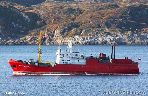
Kapitan Rogozin
Current StatusWhere is the vessel?
Kapitan Rogozin is currently in 206 nm SE of Hopen, based on AIS data received less than 1h ago.
Latest AIS update:
Current position: 74.17525° N, 34.92789° E (206 nm SE of Hopen)
Average speed (last 7 days): Loading…
Average speed (last 30 days): Loading…
Vessel profile: Kapitan Rogozin is a Fishing Vessel with dimensions 10m x 55m.
This page combines live AIS, route history, probable destination signals, nearby traffic, and port activity for practical vessel monitoring.
The current position of vessel Kapitan Rogozin is 74.17525 lat / 34.92789 lng. Updated: 2026-05-14 21:10:09 UTCNearest reference points:
- 128 nm NE of Vardo
Details:
Live Vessel Kapitan Rogozin Analytics (details, animations, etc.)
Recent AIS points (UTC):
2026-05-14 18:11:09 UTC · 74.20543, 35.03745 · SOG 2.7 kn · COG 4°2026-05-14 19:38:29 UTC · 74.25479, 35.04584 · SOG 3.1 kn · COG 10°
2026-05-14 19:47:17 UTC · 74.25893, 35.04641 · SOG 2.4 kn · COG 10°
2026-05-14 21:10:09 UTC · 74.17525, 34.92789 · SOG 7.7 kn · COG 176°