 vesseltracker.com
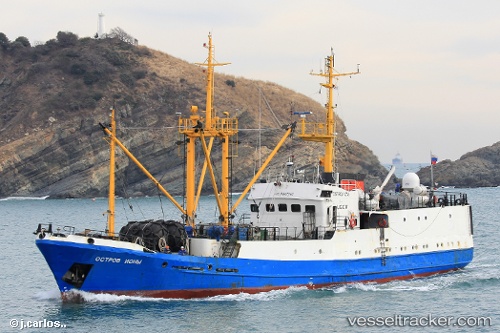
Ostrov Iony
Current StatusWhere is the vessel?
Ostrov Iony is currently in 129 nm S of Pakhachi, based on AIS data received about 1h ago.
Latest AIS update:
Current position: 58.42570° N, 168.66669° E (129 nm S of Pakhachi)
Average speed (last 7 days): Loading…
Average speed (last 30 days): Loading…
Vessel profile: Ostrov Iony is a Fish Carrier with dimensions 10m x 46m.
This page combines live AIS, route history, probable destination signals, nearby traffic, and port activity for practical vessel monitoring.
The current position of vessel Ostrov Iony is 58.42570 lat / 168.66669 lng. Updated: 2026-05-15 18:03:03 UTCNearest reference points:
- 10 nm S of Tilichiki
Details:
Live Vessel Ostrov Iony Analytics (details, animations, etc.)
Recent AIS points (UTC):
2026-05-15 13:51:50 UTC · 58.80400, 169.45428 · SOG 8.1 kn · COG 228°2026-05-15 16:16:37 UTC · 58.58603, 168.99606 · SOG 7.7 kn · COG 221°
2026-05-15 16:16:37 UTC · 58.58603, 168.99606 · SOG 7.7 kn · COG 221°
2026-05-15 18:03:03 UTC · 58.42570, 168.66669 · SOG 7.6 kn · COG 224°