 vesseltracker.com
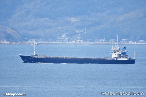
 Hong Chang
Current Status
Where is the vessel?
Hong Chang is currently in 43 nm NW of Conakry, based on AIS data received less than 1h ago.
Latest AIS update:
Current position: 9.85833° N, 14.36167° W (43 nm NW of Conakry)
Average speed (last 7 days): Loading…
Average speed (last 30 days): Loading…
Vessel profile: Hong Chang is a General Cargo Ship with dimensions 75m x 12m.
This page combines live AIS, route history, probable destination signals, nearby traffic, and port activity for practical vessel monitoring.
The current position of vessel Hong Chang is 9.85833 lat / -14.36167 lng. Updated: 2026-05-14 11:29:20 UTCNearest reference points:
- 49 nm S of Port de Boké
- 14 nm S of Port de Boké
- Near Port de Boké
Currently sailing under the flag of Belize ![]()
Details:
Live Vessel Hong Chang Analytics (details, animations, etc.)
Recent AIS points (UTC):
2026-05-14 07:17:09 UTC · 10.02333, -14.09167 · SOG 7 kn · COG -1°2026-05-14 09:23:21 UTC · 9.87833, -14.28167 · SOG 7 kn · COG -1°
2026-05-14 10:35:18 UTC · 9.85833, -14.36167 · SOG 0 kn · COG -1°
2026-05-14 11:29:20 UTC · 9.85833, -14.36167 · SOG 0 kn · COG -1°