 vesseltracker.com
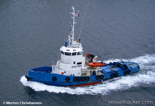
 Tronds Max
Current Status
Where is the vessel?
Tronds Max is currently in Near Stord, based on AIS data received less than 1h ago.
Latest AIS update:
Current position: 59.78722° N, 5.53233° E (Near Stord)
Average speed (last 7 days): Loading…
Average speed (last 30 days): Loading…
Vessel profile: Tronds Max is a Tug with dimensions 31m x 7m.
This page combines live AIS, route history, probable destination signals, nearby traffic, and port activity for practical vessel monitoring.
The current position of vessel Tronds Max is 59.78722 lat / 5.53233 lng. Updated: 2026-05-13 23:51:36 UTCNearest reference points:
- Near Valevåg
- Near Halsnøy
- Near SANDVIKVAAG
Currently sailing under the flag of Norway ![]()
Details:
Live Vessel Tronds Max Analytics (details, animations, etc.)
Recent AIS points (UTC):
2026-05-13 19:55:18 UTC · 59.78727, 5.53233 · SOG 0 kn · COG 192°2026-05-13 21:51:35 UTC · 59.78724, 5.53233 · SOG 0 kn · COG 192°
2026-05-13 22:57:29 UTC · 59.78727, 5.53247 · SOG 0 kn · COG 192°
2026-05-13 23:51:36 UTC · 59.78722, 5.53233 · SOG 0 kn · COG 191°