 vesseltracker.com
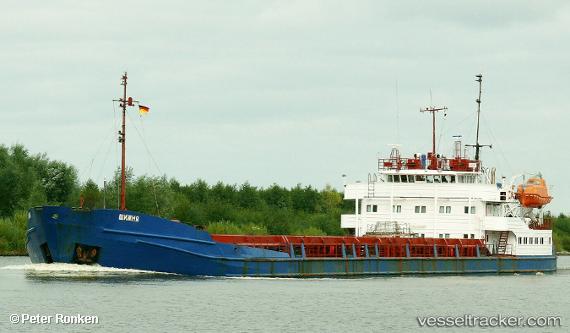
 Oneriva 45
Current Status
Where is the vessel?
Oneriva 45 is currently in 15 nm SW of Taman', based on AIS data received about 2d ago.
Latest AIS update:
Current position: 45.00333° N, 36.53833° E (15 nm SW of Taman')
Average speed (last 7 days): Loading…
Average speed (last 30 days): Loading…
Vessel profile: Oneriva 45 is a General Cargo Ship with dimensions 105m x 16m.
This page combines live AIS, route history, probable destination signals, nearby traffic, and port activity for practical vessel monitoring.
The current position of vessel Oneriva 45 is 45.00333 lat / 36.53833 lng. Updated: 2026-05-15 19:25:51 UTCNearest reference points:
- 14 nm SW of Taman'
- 17 nm SW of Taman'
- 17 nm S of Taman'
Currently sailing under the flag of Russia ![]()
Oneriva 45 built in 1987 year
Deadweight:
3997 tDetails:
Live Vessel Oneriva 45 Analytics (details, animations, etc.)
Recent AIS points (UTC):
2026-05-15 19:25:51 UTC · 45.00333, 36.53833 · SOG 3 kn · COG -1°2026-05-15 19:25:51 UTC · 45.00333, 36.53833 · SOG 3 kn · COG -1°
2026-05-15 19:25:51 UTC · 45.00333, 36.53833 · SOG 3 kn · COG -1°
2026-05-15 19:25:51 UTC · 45.00333, 36.53833 · SOG 3 kn · COG -1°