 vesseltracker.com
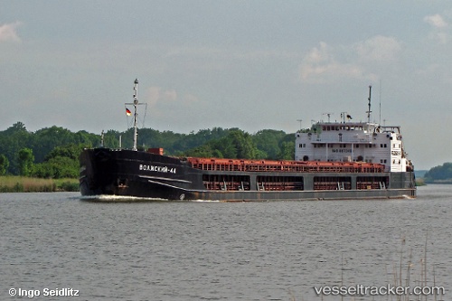
 Volzhskiy 44
Current Status
Where is the vessel?
Volzhskiy 44 is currently in Near NEMRUT, based on AIS data received about 1h ago.
Latest AIS update:
Current position: 38.76392° N, 26.92223° E (Near NEMRUT)
Average speed (last 7 days): Loading…
Average speed (last 30 days): Loading…
Vessel profile: Volzhskiy 44 is a General Cargo Ship with dimensions 139m x 16m.
This page combines live AIS, route history, probable destination signals, nearby traffic, and port activity for practical vessel monitoring.
The current position of vessel Volzhskiy 44 is 38.76392 lat / 26.92223 lng. Updated: 2026-05-15 14:00:46 UTCNearest reference points:
- Near NEMRUT
- Near Nemrut Bay
- Near Aliaga
Currently sailing under the flag of Russia ![]()
Volzhskiy 44 built in 1991 year
Deadweight:
6050 tDetails:
Live Vessel Volzhskiy 44 Analytics (details, animations, etc.)
Recent AIS points (UTC):
2026-05-15 10:25:45 UTC · 38.76393, 26.92221 · SOG 0.1 kn · COG 192°2026-05-15 11:41:42 UTC · 38.76388, 26.92225 · SOG 0.1 kn · COG 192°
2026-05-15 13:37:42 UTC · 38.76389, 26.92221 · SOG 0 kn · COG 192°
2026-05-15 14:00:46 UTC · 38.76392, 26.92223 · SOG 0 kn · COG 193°