 vesseltracker.com
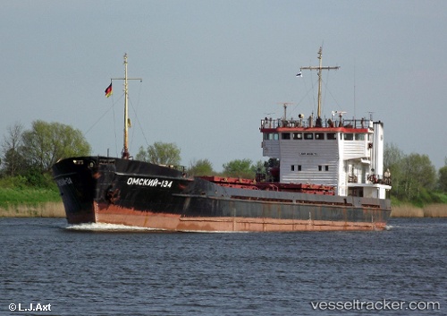
Omskiy 134
Current StatusWhere is the vessel?
Omskiy 134 is currently in Near PENDIK, based on AIS data received less than 1h ago.
Latest AIS update:
Current position: 40.86304° N, 29.19307° E (Near PENDIK)
Average speed (last 7 days): Loading…
Average speed (last 30 days): Loading…
Vessel profile: Omskiy 134 is a General Cargo Ship with dimensions 15m x 108m.
This page combines live AIS, route history, probable destination signals, nearby traffic, and port activity for practical vessel monitoring.
The current position of vessel Omskiy 134 is 40.86304 lat / 29.19307 lng. Updated: 2026-04-18 06:14:28 UTCNearest reference points:
- Near TUZLA
- Near PENDIK
- Near Tuzla Free Zone
Details:
Live Vessel Omskiy 134 Analytics (details, animations, etc.)
Recent AIS points (UTC):
2026-04-17 23:56:29 UTC · 40.86295, 29.19176 · SOG 0.1 kn · COG 28°2026-04-18 01:44:29 UTC · 40.86293, 29.19237 · SOG 0.2 kn · COG 11°
2026-04-18 03:59:26 UTC · 40.86295, 29.19220 · SOG 0.1 kn · COG 13°
2026-04-18 06:14:28 UTC · 40.86304, 29.19307 · SOG 0.1 kn · COG 334°