 vesseltracker.com
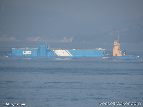
 Houun Maru
Current Status
Where is the vessel?
Houun Maru is currently in Near Ashiya, Hyogo, based on AIS data received less than 1h ago.
Latest AIS update:
Current position: 34.71950° N, 135.34335° E (Near Ashiya, Hyogo)
Average speed (last 7 days): Loading…
Average speed (last 30 days): Loading…
Vessel profile: Houun Maru is a Pusher Tug with dimensions 122m x 27m.
This page combines live AIS, route history, probable destination signals, nearby traffic, and port activity for practical vessel monitoring.
The current position of vessel Houun Maru is 34.71950 lat / 135.34335 lng. Updated: 2026-05-14 12:00:37 UTCNearest reference points:
- Near Nada-Ku, Hyogo
- Near Kobe
- Near SAKAI
Currently sailing under the flag of Japan ![]()
Details:
Live Vessel Houun Maru Analytics (details, animations, etc.)
Recent AIS points (UTC):
2026-05-14 07:52:52 UTC · 34.58680, 135.19270 · SOG 8.8 kn · COG 87°2026-05-14 10:24:42 UTC · 34.71950, 135.34334 · SOG 0 kn · COG 35°
2026-05-14 11:00:41 UTC · 34.71951, 135.34335 · SOG 0 kn · COG 35°
2026-05-14 12:00:37 UTC · 34.71950, 135.34335 · SOG 0 kn · COG 35°