 vesseltracker.com
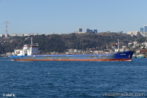
Kalitva
Current StatusWhere is the vessel?
Kalitva is currently in Near Freidoon Kenar, based on AIS data received about 9h ago.
Latest AIS update:
Current position: 36.72683° N, 52.56088° E (Near Freidoon Kenar)
Average speed (last 7 days): Loading…
Average speed (last 30 days): Loading…
Vessel profile: Kalitva is a General Cargo Ship with dimensions 15m x 108m.
This page combines live AIS, route history, probable destination signals, nearby traffic, and port activity for practical vessel monitoring.
The current position of vessel Kalitva is 36.72683 lat / 52.56088 lng. Updated: 2026-05-13 22:49:26 UTCNearest reference points:
- Near Neka
- Near Bandar Amirabad
- 50 nm W of Freidoon Kenar
Details:
Live Vessel Kalitva Analytics (details, animations, etc.)
Recent AIS points (UTC):
2026-05-13 22:49:26 UTC · 36.72683, 52.56088 · SOG 0 kn · COG 315°2026-05-13 22:49:26 UTC · 36.72683, 52.56088 · SOG 0 kn · COG 315°
2026-05-13 22:49:26 UTC · 36.72683, 52.56088 · SOG 0 kn · COG 315°
2026-05-13 22:49:26 UTC · 36.72683, 52.56088 · SOG 0 kn · COG 315°