 vesseltracker.com
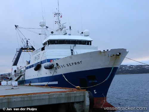
 VITUS BERING
Current Status
Where is the vessel?
VITUS BERING is currently in 42 nm NE of Ozerko, based on AIS data received less than 1h ago.
Latest AIS update:
Current position: 70.07146° N, 33.85712° E (42 nm NE of Ozerko)
Average speed (last 7 days): Loading…
Average speed (last 30 days): Loading…
Vessel profile: VITUS BERING is a Fishing Vessel with dimensions 64m x 13m.
This page combines live AIS, route history, probable destination signals, nearby traffic, and port activity for practical vessel monitoring.
The current position of vessel VITUS BERING is 70.07146 lat / 33.85712 lng. Updated: 2026-05-13 21:32:59 UTCNearest reference points:
- 23 nm N of Polyarnyy
- 12 nm N of Polyarnyy
- Near Polyarnyy
Currently sailing under the flag of Russia ![]()
VITUS BERING built in 1990 year
Deadweight:
1062 tDetails:
Live Vessel VITUS BERING Analytics (details, animations, etc.)
Recent AIS points (UTC):
2026-05-13 18:15:51 UTC · 69.49333, 33.59667 · SOG 12 kn · COG -1°2026-05-13 19:02:56 UTC · 69.65180, 33.58944 · SOG 11.6 kn · COG 357°
2026-05-13 20:16:26 UTC · 69.87253, 33.59280 · SOG 10.4 kn · COG 355°
2026-05-13 21:32:59 UTC · 70.07146, 33.85712 · SOG 9.2 kn · COG 302°