 vesseltracker.com
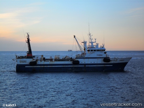
Granit
Current StatusWhere is the vessel?
Granit is currently in 42 nm SW of Grossriedenthal, based on AIS data received about 2h ago.
Latest AIS update:
Current position: 48.10661° N, 154.43861° E (42 nm SW of Grossriedenthal)
Average speed (last 7 days): Loading…
Average speed (last 30 days): Loading…
Vessel profile: Granit is a Fishing Vessel with dimensions 13m x 64m.
This page combines live AIS, route history, probable destination signals, nearby traffic, and port activity for practical vessel monitoring.
The current position of vessel Granit is 48.10661 lat / 154.43861 lng. Updated: 2026-05-13 19:46:18 UTCDetails:
Live Vessel Granit Analytics (details, animations, etc.)
Recent AIS points (UTC):
2026-05-13 16:39:09 UTC · 47.92866, 154.50084 · SOG 2.6 kn · COG 196°2026-05-13 17:42:38 UTC · 48.04256, 154.51089 · SOG 9.1 kn · COG 10°
2026-05-13 19:12:02 UTC · 48.11730, 154.47968 · SOG 3.3 kn · COG 276°
2026-05-13 19:46:18 UTC · 48.10661, 154.43861 · SOG 3.3 kn · COG 248°