 vesseltracker.com
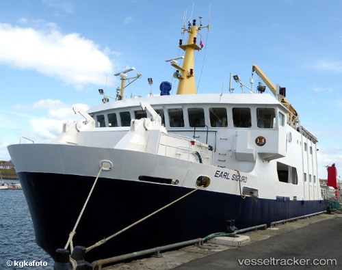
 Earl Sigurd
Current Status
Where is the vessel?
Earl Sigurd is currently in Near Orkney, based on AIS data received less than 1h ago.
Latest AIS update:
Current position: 59.07059° N, 2.94684° W (Near Orkney)
Average speed (last 7 days): Loading…
Average speed (last 30 days): Loading…
Vessel profile: Earl Sigurd is a Passenger Ro Ro Cargo Ship with dimensions 45m x 12m.
This page combines live AIS, route history, probable destination signals, nearby traffic, and port activity for practical vessel monitoring.
The current position of vessel Earl Sigurd is 59.07059 lat / -2.94684 lng. Updated: 2026-05-01 10:03:51 UTCNearest reference points:
- Near Tingwall
- Near STROMNESS
- Near Staxigoe
Currently sailing under the flag of United Kingdom ![]()
Earl Sigurd built in 1990 year
Deadweight:
231 tDetails:
Live Vessel Earl Sigurd Analytics (details, animations, etc.)
Recent AIS points (UTC):
2026-05-01 07:54:59 UTC · 59.22693, -2.86232 · SOG 11.7 kn · COG 193°2026-05-01 08:21:18 UTC · 59.12063, -2.86931 · SOG 14 kn · COG 210°
2026-05-01 10:00:52 UTC · 59.06280, -2.95526 · SOG 10.8 kn · COG 19°
2026-05-01 10:03:51 UTC · 59.07059, -2.94684 · SOG 10.7 kn · COG 35°